It starts from the hamlet of Carpini, on the main road between Umbertide and Pietralunga.
You walk on the road that runs from the church to the cemetery. The road becomes gravelled, then you turn left at a bend, in proximity of the crossroads with a farmhouse.
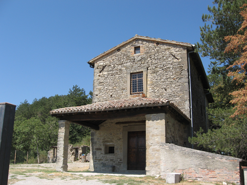
A bit further up, you see the farmhouse part of the vast number of possessions of the Conte (Earl) Della Porta that stretched far beyond Rocca d’ Aries. Going up you enjoy a view over the Carpina Valley and over the opposite mountains that you partly go through. Along the stony path, there are two bars easily bypassable. Going uphill you cross the path 115 that you follow towards Montone, then you descend to the left at the crossroads. Further up on the right there is the rural church of the Madonna del Nespolo. The trail, along the same route of the “ Ippovia Umbra” (Umbria Horse Trail), meets a wider road which continues straight along the ridge. You ignore the path that descends to the left, and continue to the right around the knoll of Civitella and at the intersection you always continue along the trail 115. The descent is first accompanied by a forest of oaks and maples and then by a pine forest. Going past a house, you come to a place called “Tre Ponti” at the confluence of the Carpina and Carpinella rivers. You use one of the bridges to cross the main road and continue along the road 116: a gravel track that climbs for 430 m up to the house “Campo della Fiora”. You continue along the fence and soon after, at a crossroads, you’d better keep left along a shaded path. After another intersection you continue to climb on the right and when you are about to go around the knoll you see the village of Montone. Then you meet a gravel road, keeping left in a few minutes you will reach the “ Madonna dei Confini”.
The trail stretches along a ridge between two valleys: the Carpinella, surrounded by Monte Gengarella, marked by the ruins of Castriciano and the Valley of the Rio San Faustino barred by the slopes of the mountain and by the Rancino; over the horizon you can see the ever-present Monte Nerone .
You go straight to a crossroads consisting of roads, small streets and paths; you run through what was once the farmyard of the Moravola family, then you arrive at a farm that you pass by carrying on along the edge of the wood to the right, always following the trail 116.
After passing a stream, you start climbing; when you reach a meadow, behind a nut tree you climb a steep slope with lots of openable gates that lead to the ruins of Casa Bazzucaglia (610 m). The path opens to a wider gravel road that you take on the left to reach the monastery of San Faustino in a short time.
After passing the Abbey you turn immediately left, thus entering into a vast pastureland. Here pay attention to the sign n.116 by walking along the fence that runs high; after an awkward passage through the fence netting, you walk along another field as far as a retractable gate from where you take a path descending to the left.
You pass a ditch and go up to a crossroads where you take a gravel path on the left, then you immediately turn right before arriving at the house Valbona.
Now the easy road stretches towards the valley verging on the “ Diavolaccio”, name given by peasants to the Cavagnetti locality.
Once in the valley, you cross a bridge, then at the fork to Monte Valentino, keeping left, you come to the main road. After four hundred metres on the left and you find your car.
|
Period: All year round, except for winter months
|
Condition signposting: trail signposted by red/white paint. Status maintance: Length: 18 KM Difference: 650 m Duration: 5 45’ ore Download PDF Download GPX Download KML Download KMZ |

